[{"id":"4012","price":"","sale":"","sale_percent":"","link":"https:\/\/geosearth.com\/portada\/receptor-gnss-laser-jupiter-rtk\/","name":"receptor-gnss-laser-jupiter-rtk","thumbnail":{"url":"https:\/\/geosearth.com\/wp-content\/uploads\/2026\/05\/Laser-Jupiter-RTK-GNSS.webp","alt":""},"title":"Receptor GNSS: L\u00e1ser J\u00fapiter RTK","author":{"name":"geos","link":"https:\/\/geosearth.com\/author\/geos\/"},"date":"May 26, 2026","dateGMT":"2026-05-26 20:45:56","modifiedDate":"2026-05-27 16:31:12","modifiedDateGMT":"2026-05-27 21:31:12","commentCount":"0","commentStatus":"closed","categories":{"coma":"<a href=\"https:\/\/geosearth.com\/category\/portada\/\" rel=\"category tag\">portada<\/a>, <a href=\"https:\/\/geosearth.com\/category\/productos\/\" rel=\"category tag\">productos<\/a>","space":"<a href=\"https:\/\/geosearth.com\/category\/portada\/\" rel=\"category tag\">portada<\/a> <a href=\"https:\/\/geosearth.com\/category\/productos\/\" rel=\"category tag\">productos<\/a>"},"taxonomies":{"post_tag":""},"acf_fields":[],"readTime":{"min":4,"sec":15},"status":"publish","content":"L\u00e1ser J\u00fapiter RTK Caracter\u00edsticas El Jupiter Laser RTK es un receptor GNSS de alta gama que integra tecnolog\u00edas avanzadas de GNSS, IMU, l\u00e1ser y c\u00e1maras"},{"id":"4002","price":"","sale":"","sale_percent":"","link":"https:\/\/geosearth.com\/portada\/sonda-acustica-portatil-hyd10\/","name":"sonda-acustica-portatil-hyd10","thumbnail":{"url":"https:\/\/geosearth.com\/wp-content\/uploads\/2026\/05\/ecosonda-portatil-hyd10.webp","alt":""},"title":"Sonda ac\u00fastica port\u00e1til HYD10","author":{"name":"geos","link":"https:\/\/geosearth.com\/author\/geos\/"},"date":"May 25, 2026","dateGMT":"2026-05-25 19:41:02","modifiedDate":"2026-05-27 15:44:19","modifiedDateGMT":"2026-05-27 20:44:19","commentCount":"0","commentStatus":"closed","categories":{"coma":"<a href=\"https:\/\/geosearth.com\/category\/portada\/\" rel=\"category tag\">portada<\/a>, <a href=\"https:\/\/geosearth.com\/category\/productos\/\" rel=\"category tag\">productos<\/a>","space":"<a href=\"https:\/\/geosearth.com\/category\/portada\/\" rel=\"category tag\">portada<\/a> <a href=\"https:\/\/geosearth.com\/category\/productos\/\" rel=\"category tag\">productos<\/a>"},"taxonomies":{"post_tag":""},"acf_fields":[],"readTime":{"min":1,"sec":40},"status":"publish","content":"Caracter\u00edsticas El HYD10 es una sonda port\u00e1til de nueva generaci\u00f3n desarrollada por ComNav. Con un dise\u00f1o compacto, permite la medici\u00f3n autom\u00e1tica de la profundidad. Gracias"},{"id":"3996","price":"","sale":"","sale_percent":"","link":"https:\/\/geosearth.com\/portada\/ecosonda-hyd300\/","name":"ecosonda-hyd300","thumbnail":{"url":"https:\/\/geosearth.com\/wp-content\/uploads\/2026\/05\/ECOSONDA-HYD300.webp","alt":""},"title":"Ecosonda HYD300","author":{"name":"geos","link":"https:\/\/geosearth.com\/author\/geos\/"},"date":"May 25, 2026","dateGMT":"2026-05-25 19:04:50","modifiedDate":"2026-05-25 14:07:12","modifiedDateGMT":"2026-05-25 19:07:12","commentCount":"0","commentStatus":"closed","categories":{"coma":"<a href=\"https:\/\/geosearth.com\/category\/portada\/\" rel=\"category tag\">portada<\/a>, <a href=\"https:\/\/geosearth.com\/category\/productos\/\" rel=\"category tag\">productos<\/a>","space":"<a href=\"https:\/\/geosearth.com\/category\/portada\/\" rel=\"category tag\">portada<\/a> <a href=\"https:\/\/geosearth.com\/category\/productos\/\" rel=\"category tag\">productos<\/a>"},"taxonomies":{"post_tag":""},"acf_fields":[],"readTime":{"min":1,"sec":16},"status":"publish","content":"HYD300: Ecosonda ac\u00fastica profesional para levantamientos hidrogr\u00e1ficos de alta precisi\u00f3n La HYD300 es una ecosonda ac\u00fastica dise\u00f1ada para trabajos hidrogr\u00e1ficos profesionales, ideal para medir profundidades"},{"id":"3926","price":"","sale":"","sale_percent":"","link":"https:\/\/geosearth.com\/productos\/escaner-laser-fjd-trion-p2\/","name":"escaner-laser-fjd-trion-p2","thumbnail":{"url":"https:\/\/geosearth.com\/wp-content\/uploads\/2026\/05\/escanerlidarp2.jpg","alt":""},"title":"Esc\u00e1ner L\u00e1ser FJD Trion P2","author":{"name":"geos","link":"https:\/\/geosearth.com\/author\/geos\/"},"date":"May 18, 2026","dateGMT":"2026-05-18 18:53:07","modifiedDate":"2026-05-26 22:46:12","modifiedDateGMT":"2026-05-27 03:46:12","commentCount":"0","commentStatus":"open","categories":{"coma":"<a href=\"https:\/\/geosearth.com\/category\/productos\/\" rel=\"category tag\">productos<\/a>","space":"<a href=\"https:\/\/geosearth.com\/category\/productos\/\" rel=\"category tag\">productos<\/a>"},"taxonomies":{"post_tag":""},"acf_fields":[],"readTime":{"min":4,"sec":27},"status":"publish","content":"M\u00e1s peque\u00f1o, m\u00e1s inteligente, escanea m\u00e1s. El FJD Trion P2 marca una nueva generaci\u00f3n en tecnolog\u00eda LiDAR port\u00e1til, dise\u00f1ado para ofrecer precisi\u00f3n centim\u00e9trica, procesamiento en"},{"id":"3875","price":"","sale":"","sale_percent":"","link":"https:\/\/geosearth.com\/portada\/iusv-8-vehiculo-de-superficie-autonomo-para-levantamientos-hidrograficos\/","name":"iusv-8-vehiculo-de-superficie-autonomo-para-levantamientos-hidrograficos","thumbnail":{"url":"https:\/\/geosearth.com\/wp-content\/uploads\/2026\/05\/USV-iUSV-82.jpg","alt":""},"title":"iUSV-8: Veh\u00edculo de superficie aut\u00f3nomo para levantamientos hidrogr\u00e1ficos","author":{"name":"geos","link":"https:\/\/geosearth.com\/author\/geos\/"},"date":"May 12, 2026","dateGMT":"2026-05-13 03:35:00","modifiedDate":"2026-05-25 13:33:41","modifiedDateGMT":"2026-05-25 18:33:41","commentCount":"0","commentStatus":"closed","categories":{"coma":"<a href=\"https:\/\/geosearth.com\/category\/portada\/\" rel=\"category tag\">portada<\/a>, <a href=\"https:\/\/geosearth.com\/category\/productos\/\" rel=\"category tag\">productos<\/a>","space":"<a href=\"https:\/\/geosearth.com\/category\/portada\/\" rel=\"category tag\">portada<\/a> <a href=\"https:\/\/geosearth.com\/category\/productos\/\" rel=\"category tag\">productos<\/a>"},"taxonomies":{"post_tag":"<a href='https:\/\/geosearth.com\/tag\/hidrografia\/' rel='post_tag'>Hidrograf\u00eda<\/a>"},"acf_fields":[],"readTime":{"min":2,"sec":54},"status":"publish","content":"iUSV-8iUSV-8: Professional Grade & Full-Functional PlatformCOTIZAR iUSV-8El iUSV-8 es una plataforma integral para la topograf\u00eda y detecci\u00f3n hidrogr\u00e1fica. Dise\u00f1ado para misiones de topograf\u00eda profesionales complejas,"},{"id":"3789","price":"","sale":"","sale_percent":"","link":"https:\/\/geosearth.com\/portada\/iso\/","name":"iso","thumbnail":{"url":"https:\/\/geosearth.com\/wp-content\/uploads\/2025\/10\/certificaciones-iso-geosearth-2025.jpg","alt":""},"title":"Nos comprometemos con los m\u00e1s altos est\u00e1ndares internacionales de calidad, sostenibilidad y \u00e9tica empresarial","author":{"name":"John Maylle","link":"https:\/\/geosearth.com\/author\/john\/"},"date":"Oct 5, 2025","dateGMT":"2025-10-05 22:28:56","modifiedDate":"2025-10-05 17:44:49","modifiedDateGMT":"2025-10-05 22:44:49","commentCount":"0","commentStatus":"open","categories":{"coma":"<a href=\"https:\/\/geosearth.com\/category\/portada\/\" rel=\"category tag\">portada<\/a>","space":"<a href=\"https:\/\/geosearth.com\/category\/portada\/\" rel=\"category tag\">portada<\/a>"},"taxonomies":{"post_tag":""},"acf_fields":[],"readTime":{"min":0,"sec":0},"status":"publish","content":""},{"id":"3730","price":"","sale":"","sale_percent":"","link":"https:\/\/geosearth.com\/productos\/escaner-lidar-fjd-trion-s2-series\/","name":"escaner-lidar-fjd-trion-s2-series","thumbnail":{"url":"https:\/\/geosearth.com\/wp-content\/uploads\/2025\/08\/FJD-TRION-S2-series.webp","alt":""},"title":"ESC\u00c1NER LIDAR FJD TRION S2 SERIES","author":{"name":"John Maylle","link":"https:\/\/geosearth.com\/author\/john\/"},"date":"Ago 26, 2025","dateGMT":"2025-08-27 03:31:35","modifiedDate":"2026-05-27 15:53:23","modifiedDateGMT":"2026-05-27 20:53:23","commentCount":"0","commentStatus":"closed","categories":{"coma":"<a href=\"https:\/\/geosearth.com\/category\/productos\/\" rel=\"category tag\">productos<\/a>","space":"<a href=\"https:\/\/geosearth.com\/category\/productos\/\" rel=\"category tag\">productos<\/a>"},"taxonomies":{"post_tag":""},"acf_fields":[],"readTime":{"min":4,"sec":36},"status":"publish","content":"Precisi\u00f3n de 1,2 cm Colorizaci\u00f3n en tiempo real Algoritmos multi-SLAM Nube de puntos georreferenciada Adaptaci\u00f3n a m\u00faltiples escenarios Escaneo en interiores y exteriores MENOR TAMA\u00d1O,"},{"id":"3468","price":"","sale":"","sale_percent":"","link":"https:\/\/geosearth.com\/productos\/tablet-gnss-t10\/","name":"tablet-gnss-t10","thumbnail":{"url":"https:\/\/geosearth.com\/wp-content\/uploads\/2024\/10\/xyztablett10.jpg","alt":""},"title":"TABLET GNSS T10","author":{"name":"John Maylle","link":"https:\/\/geosearth.com\/author\/john\/"},"date":"Oct 20, 2024","dateGMT":"2024-10-20 20:13:24","modifiedDate":"2026-05-09 21:12:07","modifiedDateGMT":"2026-05-10 02:12:07","commentCount":"0","commentStatus":"closed","categories":{"coma":"<a href=\"https:\/\/geosearth.com\/category\/productos\/\" rel=\"category tag\">productos<\/a>","space":"<a href=\"https:\/\/geosearth.com\/category\/productos\/\" rel=\"category tag\">productos<\/a>"},"taxonomies":{"post_tag":""},"acf_fields":[],"readTime":{"min":1,"sec":37},"status":"publish","content":"PANTALLA HD DE 10,1\" La gran pantalla t\u00e1ctil HD de 10,1\" legible bajo la luz del sol del T10 ofrece una experiencia visual y operativa"},{"id":"3455","price":"","sale":"","sale_percent":"","link":"https:\/\/geosearth.com\/productos\/tablet-gnss-t8-pro\/","name":"tablet-gnss-t8-pro","thumbnail":{"url":"https:\/\/geosearth.com\/wp-content\/uploads\/2024\/10\/T8-PRO-SINGULARXYZ.jpg","alt":""},"title":"Tablet GNSS T8 PRO","author":{"name":"John Maylle","link":"https:\/\/geosearth.com\/author\/john\/"},"date":"Oct 20, 2024","dateGMT":"2024-10-20 18:05:11","modifiedDate":"2026-05-12 22:49:57","modifiedDateGMT":"2026-05-13 03:49:57","commentCount":"0","commentStatus":"closed","categories":{"coma":"<a href=\"https:\/\/geosearth.com\/category\/productos\/\" rel=\"category tag\">productos<\/a>","space":"<a href=\"https:\/\/geosearth.com\/category\/productos\/\" rel=\"category tag\">productos<\/a>"},"taxonomies":{"post_tag":""},"acf_fields":[],"readTime":{"min":1,"sec":46},"status":"publish","content":"PRECISI\u00d3N EN CENT\u00cdMETROS Integrado con un m\u00f3dulo GNSS de alta precisi\u00f3n, el T8 Pro puede rastrear simult\u00e1neamente todas las constelaciones en ejecuci\u00f3n y planificadas, proporcionando"},{"id":"3444","price":"","sale":"","sale_percent":"","link":"https:\/\/geosearth.com\/productos\/receptor-gnss-y1\/","name":"receptor-gnss-y1","thumbnail":{"url":"https:\/\/geosearth.com\/wp-content\/uploads\/2024\/10\/y1-gnss-receiver-singularxyz.jpg","alt":""},"title":"RECEPTOR GNSS Y1","author":{"name":"John Maylle","link":"https:\/\/geosearth.com\/author\/john\/"},"date":"Oct 20, 2024","dateGMT":"2024-10-20 15:45:51","modifiedDate":"2026-05-09 15:43:51","modifiedDateGMT":"2026-05-09 20:43:51","commentCount":"0","commentStatus":"closed","categories":{"coma":"<a href=\"https:\/\/geosearth.com\/category\/productos\/\" rel=\"category tag\">productos<\/a>","space":"<a href=\"https:\/\/geosearth.com\/category\/productos\/\" rel=\"category tag\">productos<\/a>"},"taxonomies":{"post_tag":""},"acf_fields":[],"readTime":{"min":3,"sec":20},"status":"publish","content":"CONSTELACI\u00d3N COMPLETA Con 1598 canales para el seguimiento completo de la constelaci\u00f3n, el Y1 puede ofrecer un posicionamiento confiable con precisi\u00f3n de nivel centim\u00e9trico. Gracias"},{"id":"3414","price":"","sale":"","sale_percent":"","link":"https:\/\/geosearth.com\/productos\/receptor-gnss-x1-pro\/","name":"receptor-gnss-x1-pro","thumbnail":{"url":"https:\/\/geosearth.com\/wp-content\/uploads\/2024\/10\/xyz.X1.Pro_.jpg","alt":""},"title":"RECEPTOR GNSS X1 PRO","author":{"name":"John Maylle","link":"https:\/\/geosearth.com\/author\/john\/"},"date":"Oct 19, 2024","dateGMT":"2024-10-19 20:15:00","modifiedDate":"2026-05-11 20:39:44","modifiedDateGMT":"2026-05-12 01:39:44","commentCount":"0","commentStatus":"closed","categories":{"coma":"<a href=\"https:\/\/geosearth.com\/category\/productos\/\" rel=\"category tag\">productos<\/a>","space":"<a href=\"https:\/\/geosearth.com\/category\/productos\/\" rel=\"category tag\">productos<\/a>"},"taxonomies":{"post_tag":""},"acf_fields":[],"readTime":{"min":4,"sec":34},"status":"publish","content":"Constelaci\u00f3n completa, fija en segundos Con seguimiento de se\u00f1al resistente de constelaci\u00f3n completa, antiinterferencias robusto y algoritmo RTK avanzado, X1 Pro solo tarda unos segundos"},{"id":"3381","price":"","sale":"","sale_percent":"","link":"https:\/\/geosearth.com\/productos\/receptor-gnss-orion-one\/","name":"receptor-gnss-orion-one","thumbnail":{"url":"https:\/\/geosearth.com\/wp-content\/uploads\/2024\/10\/RECEPTOR-GNSS-ORION-ONE.jpg","alt":""},"title":"RECEPTOR GNSS ORION ONE","author":{"name":"John Maylle","link":"https:\/\/geosearth.com\/author\/john\/"},"date":"Oct 19, 2024","dateGMT":"2024-10-19 18:11:25","modifiedDate":"2026-05-12 22:59:41","modifiedDateGMT":"2026-05-13 03:59:41","commentCount":"0","commentStatus":"closed","categories":{"coma":"<a href=\"https:\/\/geosearth.com\/category\/productos\/\" rel=\"category tag\">productos<\/a>","space":"<a href=\"https:\/\/geosearth.com\/category\/productos\/\" rel=\"category tag\">productos<\/a>"},"taxonomies":{"post_tag":""},"acf_fields":[],"readTime":{"min":4,"sec":33},"status":"publish","content":"Peque\u00f1o en mano, poderoso en estudio Orion ONE est\u00e1 dise\u00f1ado con un dise\u00f1o compacto de \u03a6107 mm \u00d7 58,7 mm del tama\u00f1o de la palma"}]
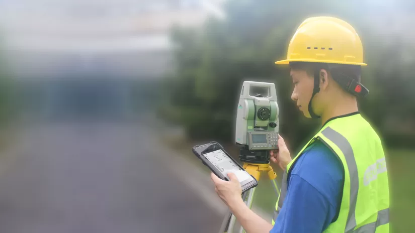
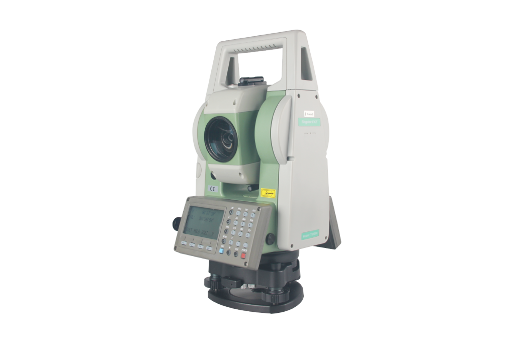
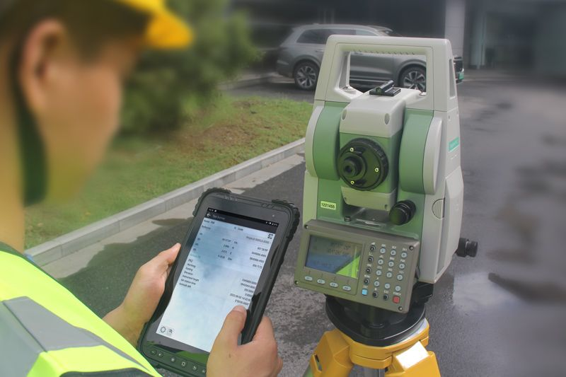
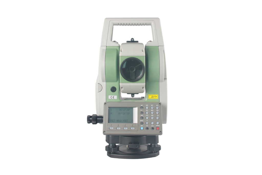
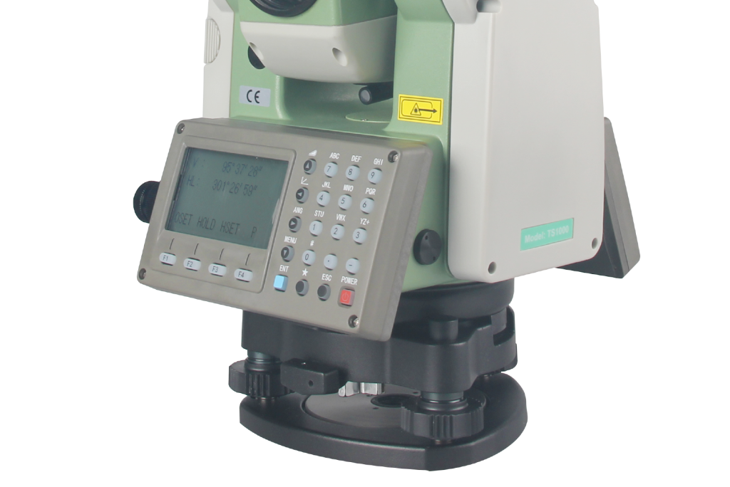
La estación total TS1000 admite un rango de medición sin prisma de hasta 1000 m. Con un solo prisma, el alcance se puede ampliar a 7500 m con una precisión de 2 mm.